
Based in Columbus, GA and Proudly Serving Communities Across East Alabama and West Central Georgia
REGIONAL COVERAGE BUILT AROUND HOW CLIENTS WORK.
QuickView serves the Chattahoochee Valley and surrounding areas of west-central Georgia and east-central Alabama. Coverage is organized into four practical regions that reflect construction, industrial, infrastructure, land and property needs across the area.
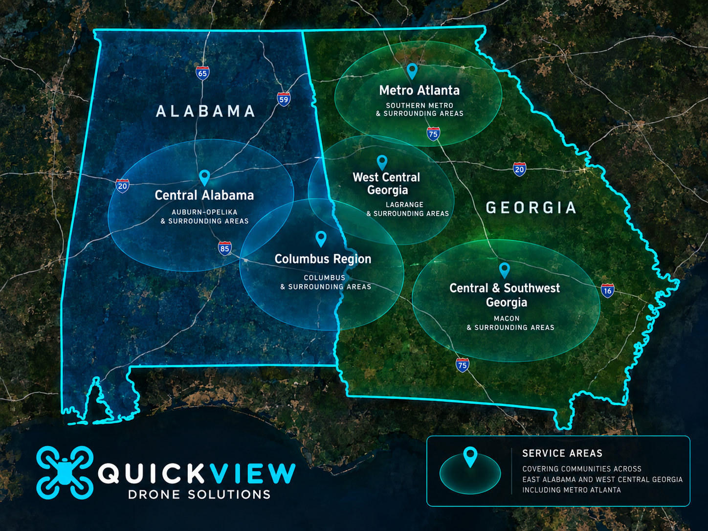
Our Primary Service Regions
Regional coverage preserves useful local search terms while keeping the website navigation clean and understandable.
Greater Columbus & Lower Chattahoochee
Columbus, Phenix City, Smiths Station, Fortson, Midland, Upatoi, Eufaula and surrounding communities.
This area includes active construction sites, commercial and industrial facilities, military-adjacent development, utility corridors, rural acreage and waterfront property.
Common Project Needs
- Construction progress monitoring
- Aerial mapping and site documentation
- Earthwork and stockpile measurement
- Commercial roof and facility inspection
- Infrastructure and utility inspection
- Land, acreage and real estate marketing
Auburn–Opelika & East Alabama
Auburn, Opelika, Tuskegee, Alexander City, Troy and surrounding communities.
The region continues to grow through residential development, manufacturing, logistics, education, commercial construction and lakefront property.
Common Project Needs
- Construction and development mapping
- Industrial and manufacturing documentation
- Recurring construction monitoring
- Commercial roof and thermal inspection
- Agricultural and rural property mapping
- Lake and commercial property media
LaGrange & West Georgia
LaGrange, Hamilton, Warm Springs and surrounding West Georgia communities.
West Georgia supports manufacturing, warehousing, commercial development, large construction projects, rural land, hospitality and historic properties.
Common Project Needs
- Industrial construction documentation
- Manufacturing and warehouse inspection
- Large-site mapping and measurement
- Construction progress monitoring
- Rural land and timber mapping
- Hospitality and commercial property media
Central & Southwest Georgia
Fort Valley, Americus and surrounding rural counties.
This region includes agricultural land, orchards, institutional properties, utility infrastructure, large-acreage sites and growing development.
Common Project Needs
- Agricultural and orchard mapping
- Large-acreage aerial documentation
- Utility and infrastructure inspection
- Construction mapping and monitoring
- Terrain and existing-condition modeling
- Land and development marketing
South Metro Atlanta Logistics & Industrial Corridors
Fairburn, Union City, East Point, College Park, Hapeville, Palmetto, Newnan, Peachtree City, Douglasville, McDonough and surrounding industrial corridors.
South Metro Atlanta contains extensive warehouse districts, distribution centers, airport-adjacent logistics facilities, industrial parks, large commercial roofs and active expansion projects.
Common Project Needs
- Warehouse roof and façade inspection
- Radiometric thermal documentation
- Construction progress monitoring
- Large-site mapping and measurement
- Solar and utility asset inspection
- Commercial property marketing